Public Space and Urban Justice
In academic, government and public arenas there is increasing interest in public space as a facilitator of urban justice and, further, that urban justice is not an abstract concept, but has practical implications. Therefore, the question is what are the ways of studying public space to promote urban justice in the city? The intention of this issue of Built Environment is to bring contributions which explore and ground this question.
About this issue
Summary
In academic, government and public arenas there is increasing interest in public space as a facilitator of urban justice.

Contents
-
Public Space and Urban Justice
Matej Nikšič and Ceren Sezer -
The Capitalist Political Economy and Transformation of Public Spaces: The Case of Gençlik Parkı in Ankara
A. Burak Buyukcivelek -
Cultural Visibility and Urban Justice in Immigrant Neighbourhoods of Amsterdam
Ceren Sezer and Ana Maria Fernandez Maldonado -
Is a Walkable Place a Just Place? The Case of Ljubljana
Matej Nikšič -
Equity and Empowerment in Medellín’s Informal Settlements
Eva Schwab -
Reading the Dynamics of Contemporary Urban Spaces in a Turbulent Era: A Case from Beirut
Christine Mady -
Children are Citizens Too: Consulting with Children on the Redevelopment of a Central City Square in Auckland, Aotearoa/New Zealand
Penelope Carroll, Karen Witten and Claire Stewart - Publication Reviews
Meet the editor
Tali Hatuka, an architect and urban planner, is the Head of the Laboratory of Contemporary Urban Design, in the Department of Geography and Human Environment at Tel Aviv University. Hatuka works primarily on planning and urban design issues, focusing on the relationships between urban development, city design and conflicts in contemporary cities.
Editorial: Industrial Urbanism: Exploring the City-Production Dynamic
Since the Industrial Revolution, cities and industry have evolved together; towns and metropolitan regions have grown around factories and expanding industries. Despite this shared past, however, popular notions of manufacturing tend to highlight its negative aspects: pollution, environmental degradation, and the exploitation of labour caused by growing industry, on the one hand, and – almost paradoxically – on the other, the blight, abandonment, and ‘shrinkage’ resulting from the more recent decline of manufacturing in cities in the developed world. In recent years, with the digitization of manufacturing, technological developments and environmental challenges, there is a growing recognition of the need to re-examine the interface between manufacturing and cities (Berger and Sharp, 2013; Helper et al., 2012; Leigh and Hoelzel, 2012).
Supporters of such a re-examination, warn of self-destruction in countries that promote post-industrial policy. Relocating plants to countries where labour is less expensive, as a means of reducing production costs is not a viable strategy for the long term, and severing the connection between production and development impairs the ability to innovate in source countries (De Backer et al., 2015; Manyika et al., 2012; Pisano and Shih, 2009). This trend is also backed by research which, after neglecting the subject for a period, is investing resources in it, and especially in the topic of the relationship between manufacturing and regional development. Most studies emphasize different aspects of manufacturing of critical significance to the local economy, a paradigm that also receives support from political leaders who seek to rethink the geography of manufacturing as a path that might be used to promote job opportunities.
The premise of this issue is that manufacturing, whether advanced or traditional, is much more than an economic challenge. It should be viewed as a complex socio-political project that includes four related dimensions:
- Economy: the increasing global competition for investments and projects between cities and regions;
- Society: unemployment as a side effect of globalization and the transfer of production to developing countries;
- Planning: demographic growth along with a trend toward rapid urbanization; and
- Environment: changes in consumption and the cost of energy in the transportation of goods.
Accordingly, industrial urbanism suggests that economists’ quantitative abstract framework be extended into a concrete comparative, multi-level analysis that includes the physical environment and addresses the future possible relationships between cities and industry and between current urban planning practices and the places that are being designed for and dedicated to the production of goods. More specifically, this issue focuses on the spatial implications and physical manifestation of contemporary manufacturing in the city, addressing the following:
- What are the contemporary relationships between city and industry?
- Should contemporary manufacturing be subjected to the same rules and zoning regulations as its predecessors?
- What physical planning and design strategies should cities pursue to retain, attract, and increase manufacturing activity?
- What is to be done with vacant factories, neglected industrial sites?
These questions point to the limitations of the current planning and architectural paradigm in addressing manufacturing, and the need to conceptualize new planning strategies that would respond to and help cities adapt to current trends in manufacturing. Spatial adaptation to manufacturing is required at the regional, city and local scales, in both existing and new settings, taking into account, not merely the physicality of space, but also its social and political characteristics.
This issue opens with a paper, ‘Industrial Urbanism: Typologies, Concepts and Prospects’, by Tali Hatuka and Eran Ben-Joseph, which provides an historical and typological mapping of the evolving dynamics between city and industry. Exploring some of the key models of industrial cities, it shows how they have had an enormous impact on the landscape of cities, contributing to the development of three prominent spatial prototypes of city–industry relationships: the integrated, adjacent and autonomous. The integrated prototype implies a fusion or close proximity between residential and industrial uses; the adjacent prototype implies planned segregation between the industrial and residential areas of the city through zoning; the autonomous prototype refers to standalone industrial/business parks or large factories working autonomously from both spatial and managerial perspectives. The paper maps the key features of prototypes and suggests that in the face of emerging technologies, planners must sharpen the tools for industrial environment planning. It is argued, that a holistic view of city and industry is likely to produce a new understanding of the relationship between working and living.
The following set of papers addresses the need for planning and policy-makers to adapt to the current profile of manufacturing. Advanced manufacturing technologies are seen as an opportunity that changes the cost equation of manufacturing methods, and, importantly, as an integral element in the innovation of new products, processes and services. As Elizabeth Reynolds says in her paper ‘Innovation and Production: Advanced Manufacturing Technologies, Trends and Implications for US Cities and Regions’, ‘These technologies are central to the development of new, more complex products and processes, often “hybrid” products that combine hardware with software’. Her paper provides a wide overview of the trends in advanced manufacturing and their spatial implications. Exploring these trends by looking at manufacturing in US cities and metropolitan areas, Reynolds argues that, globally, countries and regions are investing heavily in advanced manufacturing technologies because of their important link to innovation and economic development. However, the implications of these trends for urban manufacturing are mixed and uneven. Mapping the opportunities and challenges for urban manufacturing, as well as gaps in our knowledge about investments in manufacturing, she proposes an approach for thinking about urban manufacturing that blurs geographic boundaries and looks more closely at the manufacturing innovation ecosystem as a whole and how land-use strategies might support this system.
Land-use and planning regulations are indeed one of the main obstacles barring a response to current manufacturing trends. Addressing the limits of zoning and the separation of the residential environment from manufacturing in cities, Timothy Love, in his paper, ‘A New Model of Hybrid Building as a Catalyst for the Redevelopment of Urban Industrial Districts’, suggests that mixed-use industrial zoning is one approach for preserving districts in North American cities with a growing shortage of industrial and ‘back-of-house’ real estate. Mixed-use industrial development cross-subsidizes the construction of new industrial spaces with non-industrial and higher-value uses on upper floors. It supports a process of densification that results in hybrid buildings that may improve the walkability of industrial areas, thus promoting alternative transportation modes and neighbourhood retail. The paper frames the specific urban design and architectural issues raised by a mixed-use industrial building prototype and mixed-use industrial districts.
The limits of zoning practices are also addressed in ‘Zoning and its Discontents: Integrating Old Industrial Parks with the City’ by Dan Price, who presents the urban renewal of an industrial park in Kfar Saba, a town north of Tel Aviv in Israel. The paper describes the challenges in strategically regenerating an industrial park within the existing planning milieu. The project, a test case for diverse strategies involving architectural design, policy proposals and management reform, exposes the challenges in implementing ‘hybridism’. Price argues that zoning regulations from the 1960s onwards have left a legacy of single-use domains within the cities of Israel. Thus, old industrial parks present a particularly acute challenge and, also, an opportunity for town planners to address issues of social justice, economic resilience and environmental sustainability while avoiding the trap of ‘industrial gentrification’. Nina Rappaport further examines these ideas and, particularly, the concept of hybridity in her paper, ‘Hybrid Factory | Hybrid City’. Rappaport argues that factories can now be built as hybrid buildings in mixed-use neighbourhoods because industry is smaller, cleaner, and quieter. Exploring these ideas at the city scale, she adopts a normative approach and proposes that a new hybridity – both spatially and economically – might lead to more productive and vital cities.
The question of adaptation refers not merely to the evolution of manufacturing in the twenty-first century, but also to numerous abandoned heavy industrial sites worldwide. Though a strategy of reuse is becoming more common, implementation often presents economic and spatial challenges. The paper, ‘Historic Heavy Industrial Sites: Obstacles and Opportunities’, by Sunny Menozzi, maps the obstacles and opportunities in the conservation and adaptive reuse of steelworks and other heavy industrial complexes. Menozzi asks what should communities take into account before choosing to move forward with conservation and reuse. Using cases from the United States, Mexico, Germany, Luxembourg, and Italy, she concludes that communities should pursue conservation and reuse when they are seeking a civic benefit, and when it is sufficiently important to justify a substantial long-term investment in a project that may never be commercially viable.
The dilemma posed by Menozzi is richly portrayed in the case of Engenho Central de Piracicaba, Brazil. In the paper, ‘The Place of the Industrial Past: The Adaptive Reuse of the Industrial Heritage in the Engenho Central de Piracicaba, Brazil’, Gabriela Campagnol tells the history of the site’s preservation in the context of the political and urban history of the city. Since the 1980s, the site has been the subject of political controversy and stewardship debates, resulting in several adaptive reuse projects by renowned Brazilian architects, such as Oscar Niemeyer (1980), Carlos Bratke (1994), Fanucci and Ferraz/Brasil Arquitetura (2004) and Paulo Mendes da Rocha (2006). Although, as she argues, adaptive reuse has emerged as a common way to ensure the preservation of underused industrial buildings and landscapes, it should be seen as a political project.
In responding to the growing need, first, to develop new planning strategies that address current and anticipate future trends in manufacturing and, second, to reassess the reuse strategies of historical factories, it is also important to acknowledge the dominant presence of the industrial park in metropolitan regions. The autonomous, standalone industrial/business park, which hosts large factories that are disconnected, spatially and managerially from the city, has had a dominant presence in the landscape of the metropolitan region and is the leading model in developing, contemporary industrial areas. In her paper, ‘The Autonomous Industrial Park: A Global Model with Local Variations’, Roni Bar assesses the spatial features of industrial parks. She analyses industrial parks, which are often in peripheral or suburban locations, in the context of the process of decentralization and agglomeration, associated with the rise of global economies and neoliberal ideologies. Highlighting the spatial effects of industrial parks through cases from Israel, she acknowledges the varied manifestations of the industrial park and discusses the possible opportunities its spatial evolution and adaptation offers.
The issue ends with some thoughts and ideas on the future of industrial urbanism. The epilogue, ‘Facing Forward: Trends and Challenges in the Development of Industry in Cities’, written by Tali Hatuka, Eran Ben-Joseph and Sunny Menozzi, outlines some of the developments and trends in the relationship between cities and industry, as were discussed in a symposium entitled Industrial Urbanism, which was held at the Massachusetts Institute of Technology (MIT) in October 2014. The paper focuses on the three interlinked dimensions of manufacturing that might have a major impact on city planning – proximity, localism, and planning regulations – and recommends their critical assessment to address the needs of industrial urbanism in the future.
A final point – manufacturing is also about people, their work, and their daily life. Instead of supporting single-use industrial parks and standalone factories, industrial urbanism encourages the convergence of users and activities to create vibrant economic clusters. Industrial urbanism could reintroduce human-centred design to manufacturing facilities. These ideas require further research and study. Further research could analyse the changes in contemporary manufacturing sectors and the ways that they may influence future urban development, including the residential fabric and infrastructure. In addition, researchers could propose a new spatial model that re-establishes the connection between cities and industry, a prototype that meets the needs of the twenty-first century by promoting technological interfaces and advancing environmental concerns.
Manufacturing must be viewed with fresh eyes, while recognizing that it is central to sustaining thriving cities, to realize the potential of industrial urbanism. Doing so will be a major task for designers, planners, and policy-makers in the years ahead, but it is one that is sure to bear fruit and lead to better place-making.
At the end of the day, people spend most of their day in their work environment. And though we tend to discuss work and the industry as a means to achieve particular goals, seeing it as the source of all productivity, property or wealth, work, for most of us, profoundly contributes to our identity – who we are, our way of life, and what we are able to achieve in our lifetimes.
References
- Berger, S., Sharp, P.A. and the Massachusetts Institute of Technology (MIT) Task Force on Innovation and Production (2013) A Preview of the MIT Production in the Innovation Economy Report. Cambridge, MA: Massachusetts Institute of Technology. Available at: http://web.mit.edu/pie/news/PIE_Preview.pdf.
- De Backer, K., Desnoyers-James, I. and Moussiegt, L. (2015) Manufacturing or Services: That is (not) the Question: The Role of Manufacturing and Services in OECD Economies. OECD Science, Technology, and Industry Policy Papers, No. 19. Available at: http://www.oecd-ilibrary.org/science-and-technology/manufacturing-or-services-that-is-not-the-question_5js64ks09dmn-en?crawler=true.
- Helper, S., Krueger, T. and Wial, H. (2012) Locating American Manufacturing: Trends in the Geography of Production. Washington DC: The Brookings Institute. Available at: http://www.brookings.edu/research/reports/2012/05/09-locating-american-manufacturing-wial.
- Leigh, N.G. and Hoelzel, N.Z. (2012) Smart growth’s blind side. Journal of the American Planning Association, 87(1), pp. 78–89. DOI: 10.1080/01944363.2011.645274.
- Manyika, J., Sinclair, J., Dobbs, R. et al. (2012) Manufacturing the Future: The Next Era of Global Growth and Innovation. McKinsey Global Initiative and McKinsey Operations Practice, p. 2. Available at: www.mckinsey.com/business-functions/operations/our-insights/the-future-of-manufacturing.
- Pisano, G.P. and Shih, W.C. (2009) Restoring American competitiveness. Harvard Business Review, August/July. Available at: https://hbr.org/2009/07/restoring-american-competitiveness/ar/1.
Acknowledgements
Over the past 5 years, I have been working with Professor Eran Ben-Joseph (the Department of Urban Studies and Planning, MIT) on the spatial and planning features of industrial areas worldwide. Our collaborative project titled Industrial Urbanism (http://industrialurbanism.com) was exhibited at the MIT Museum in September 2014. Some of the key questions and analytical findings of this project have been used as the foundation for this issue. Recently, with Professor Eran Ben-Joseph, I have started a new study (commissioned by Ashdod City, a prominent industrial and a port city) aimed at analyzing and developing a strategic plan for Ashdod’s various industrial areas, based on the findings of this research project.

Industrial Urbanism: Exploring the City–Production Dynamic
This issue focuses on the spatial implications and physical manifestation of contemporary manufacturing in the city. In doing so it addresses four key questions. 1. What are the contemporary relationships between city and industry? 2. Should contemporary manufacturing be subjected to the same rules and zoning regulations as its predecessors? 3. What physical planning and design strategies should cities pursue to retain, attract, and increase manufacturing activity? 4. What is to be done with vacant factories and neglected industrial sites.
About this issue
Summary
This issue focuses on the spatial implications and physical manifestation of contemporary manufacturing in the city.

Contents
-
Industrial Urbanism: Exploring the City–Production Dynamic
Tali Hatuka -
Industrial Urbanism: Typologies, Concepts and Prospects
Tali Hatuka, Eran Ben-Joseph and Minjee Kim -
Innovation and Production: Advanced Manufacturing Technologies, Trends and Implications for US Cities and Regions
Elisabeth B. Reynolds -
A New Model of Hybrid Building as a Catalyst for the Redevelopment of Urban Industrial Districts
Timothy Love -
Zoning and Its Discontents: Integrating Old Industrial Parks with the City
Dan Price -
Hybrid Factory | Hybrid City
Nina Rappaport -
Historic Heavy Industrial Sites: Obstacles and Opportunities
Sunny Menozzi Peterson -
The Place of the Industrial Past: The Adaptive Reuse of the Industrial Heritage in the Engenho Central de Piracicaba, Brazil
Gabriela Campagnol -
The Autonomous Industrial Park: A Global Model with Local Variations
Roni Bar -
Facing Forward: Trends and Challenges in the Development of Industry in Cities
Tali Hatuka, Eran Ben-Joseph and Sunny Menozzi Peterson - Publication Reviews
Globalizing Seoul: The City's Cultural and Urban Change

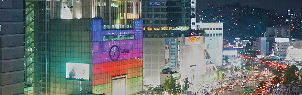
In the decades following the 1997 Asian economic crisis, South Korea sought segyehwa (globalization). Evidence of this is no more evident than in the country’s capital, Seoul, where urban development has been central to making the city a global hub and not just the centre of the national economy. However, recent development projects differ from those of the past in that they no longer focus solely on economic efficiency, but on the deployment of a new urban aesthetics. As Jieheerah Yun reveals in Globalizing Seoul: The City’s Cultural and Urban Change, the pursuit of globalization and the rebranding of Seoul’s image from hard industrial city to soft cultural city have shaped the urban development of the city.
Following a brief urban history of Seoul, she focuses on two key themes. In the first, how globalization has contributed to refashioning Korean traditions, she analyzes the policies and actions to preserve Korean folk houses and pre-industrial street layouts, looking in detail at the Bukchon and Insadong areas of the city.
Her second theme is an examination of migration and the generation of new minority neighbourhoods amidst the segyehwa policies and the state’s efforts to build a multicultural society. In detailed case studies of the redevelopment of Dongdaemun Market as part of rebranding Seoul as the ‘world design capital’ and of the Itaewon area as both a Special Tourist Zone and a Global Cultural Zone, she shows how multi-ethnic neighbourhoods are threatened by lack of consideration for economic justice and housing provision.
Jieheerah Yun is an Assistant Professor in the College of Architecture, Hongik University, Seoul, South Korea.
Contents
- Introduction: The Production of Korean Global Space
- Chapter 1 A Brief Urban History of Seoul
- Chapter 2 Rediscovered Traditions: Remodelled Hanoks in Bukchon
- Chapter 3 From Mary’s Alley to a Culture Street: Contested Traditions in Insadong
- Chapter 4 Rediscoveries and Redesigns: Dongdaemun History and Culture Park
- Chapter 5 A Foreign Country in Seoul: Itaewon’s Multicultural Streets
- Conclusion
Editorial: Winning the Last Mile
About this issue
Summary
Long-distance transport of passengers and freight is often efficient, but once in the city all forms of transport face what is known as the ‘last-mile problem’, which in reality is both a last-mile and a first-mile problem. In this issue, contributors examine a wide range of strategies to solve or, at least, reduce this problem.
Inter-city, long-distance transport of passengers and freight is often efficient – the long-distance, non-stop nature of such trips coupled with the potential to ‘assemble’ together large volumes of demand translates into higher speed, load factor and conversely lower cost, energy consumption and environmental impact (per seat or ton-km). But once at the ‘city’ it is no longer possible to benefit from these advantages due to different and multiple destinations each passenger or product needs to reach. This challenge of integrating long-distance inter-city transport with short-distance urban transport is known as the ‘last-mile problem’. Although mainly used and researched in logistics, it applies equally to passenger transport. In both cases, the car (truck or van for freight) emerges as having the upper hand over the alternatives, at least from the individual (firm or passenger) perspective. The car is the mode that can provide door-to-door travel without the need for transfer, between networks (air, rail and road) or vehicles. However, this solution, of adopting the car, has many recognized flaws from a social perspective which are also increasingly recognized from an individual perspective, mainly due to congestion.
Transport policy has changed over the last decade with ‘sustainability’, or low carbon mobility (Givoni and Banister, 2013) being used as a guiding principle. There is recognition that simply providing more infrastructure to accommodate demand is not the way forward (Banister, 2008) and, at the same time, there is recognition of the advantages offered by alternatives to the private car and freight trucks. In parallel, technological developments never stop and continue to shape the transport system. Information and Communication Technologies (ICTs) allow us to know when the next bus will come or when our delivery will be at our door; allow us to use time while travelling, but also to better navigate through the city’s congested roads. Electric motors are increasingly used, for bicycle, cars and trucks, and on the horizon Autonomous Vehicles (AVs) can be seen as a real possibility. But all these developments do not mean the last-mile problem will soon disappear – indeed current trajectories suggest this is unlikely. The focus in transport research is shifting to other challenges, but as the ‘last-mile’ problem remains a central obstacle to a better and more sustainable transport system, we must not abandon it. Especially not when the developments mentioned above provide us with an opportunity to re-examine the problem and offer a way forward.
Addressing and refocusing attention on the so-called last-mile problem or challenge requires also its redefinition. It might be that some of the problem stems from a narrow definition of the last-mile and its separation from ‘other’ miles. In this context, the aim of this special issue is to offer a broader definition for the last-mile problem and use it to re-examine urban transport and in the hope of advancing a more sustainable transport system as well as cities.
The First, Last and Only (One) Mile Problem
With the increase in the world’s urban population and increasing urbanization rates, mobility and transport research increasingly focus on this part of the network – the urban network. What is often not considered is that increasing urbanization rates will also increase the rates of interactions between cities and, as a direct result, the demand for inter-city transport services.
As manufacturing and other economic activities spread across different (national and global) cities, more goods will need to be carried in and out of cities as well as within cities. The traditional view of freight transport being in one direction from the location of natural resources outside cities into the factory (outskirts of cities) and the then the inner cities, which led to coining the problem as the last mile, is no longer valid. Freight transport is increasingly in ‘all’ directions’ and there are therefore many last miles in the production process, or supply chain (Rodrigue, 2006).
The economy of scale characteristic of inter-city travel exists also in passenger transport, as far as public transport is concerned. The parallel to freight transport is, however, different in that long-distance passenger transport usually faces the ‘last-mile’ problem already at the start of the journey. As with freight transport, most passengers’ destinations are within the city’s boundaries, but in passenger transport this is also where most trips’ origin is. Thus, the last-mile problem in freight transport becomes also a first-mile problem in passenger transport.
Regardless of a city’s size, many trips are made entirely within its boundaries. As cities and their populations grow so too does the demand for transport within cities, and accommodating this demand by utilizing economies of scale in transport provision (freight and passenger) is increasingly called for. In passenger transport this is done using public transport, starting with buses and going up the capacity ladder to bus rapid transit (BRT), light rail transit (LRT), regional rail etc. (Bruun, 2014). Thus, the last- and first-mile problem also arises when accommodating demand for transport within cities, certainly as some cities become larger and larger in area and population. Furthermore, and in addition, urban transport is largely characterized by relatively short trips, which use the same network/infrastructure as that used to feed (or access and egress) long-distance inter-city transport. Many of these trips are made by school-age children (often accompanied by parents) and are trips to and from school. In the morning peak, such trips form a significant part of the demand for transport and cannot be examined separately from other trips that together form the demand for transport. These trips, in this context, can be referred to as the ‘only’ mile trips and are responsible for the one-mile problem.
The above suggests that the last-mile problem must be more broadly defined as the first-, last- and one-mile problem. It also suggests that cities, as the focal point of the transport network, are where also inter-city transport planning must focus. This, however, turns the problem into an opportunity as it points to where the solution might lie. With this broader approach in mind this special issue looks at the first-, last- and one-mile challenge in urban transport. What this issue also sees as central is the recognition that all these trips, long and short distance, urban and inter-city, and freight and passenger transport, cannot be considered separately, but as part of the same challenge, and this resonates with the ever increasing need for integration in transport planning (see Givoni and Banister, 2010).
This Special Issue
With this broad definition of the ‘mile’ problem in mind the first three papers in the special issue adopt a contemporary perspective to consider the last (freight), last and first (passenger), and one mile (children/school) transport challenge.
Niklas Arvidsson, Moshe Givoni and Johan Woxenius in ‘Exploring Last Mile Synergies in Passenger and Freight Transport’ aim to bring together the literature on the last-mile problem in freight transport with that on integrated transport in passenger transport, which in essence looks at the same problem but from the perspective of two important types of flows in cities: of goods and passengers. By that, they explore synergies in carrying and distributing these flows across the city, especially in the context of a long-distance, inter-city and multi-modal journey. They note the tension, or competition that exists today in accommodating the demand for the transport of goods and passengers and attribute this in part to the institutional roots and separation between the ‘business’ oriented world of logistics and the ‘public’ oriented nature of passenger transport. Overcoming this institutional barrier is seen as the key for exploiting synergies in distributing passenger and freight transport across a city.
Treating the last-mile of passengers’ journey as one category is limiting and a hindrance to overcoming the last/first mile in passenger transport. Robin Hickman and Giacomo Vecia in ‘Discourses, Travel Behaviour and the ‘Last Mile’ in London’ demonstrate this in the context of travel to and from work by dividing commuters (into a London suburb) into different groups of users according to their opinion and perception of their journey to work and the transport system they encounter on the way to work, especially in the work area (the last/first mile). While acknowledging the importance of the infrastructure to accommodate walking, cycling and public transport facilities, they also emphasize the importance of giving attention to factors that influence the experience of passengers when traversing the last mile.
The idea that saving travel time is not necessarily always beneficial and desired, and that not all demand for transport is derived demand (Mokhtarian and Salomon, 2001) is often still difficult to accept in mainstream transport policy, practice and research. This notion, that minimising travel time is not a priority, is more acceptable when children’s travel is concerned. Yet, Rebecca Shliselberg and Moshe Givoni in ‘Cultural Differences in Children’s One Mile Mobility’ argue that children’s and adults’ (parents) journeys, especially in the morning, are intricately connected and therefore should not be treated separately. Parent’s first mile of the journey to work is related to children’s one or only mile journey to school, and to parents’ decision whether or not to ‘send’ the child alone (unaccompanied by an adult) to school. Independent travel of children to school might free parents from the need to drive children to school, opening the door for children to benefit and get accustomed to active transport modes and a range of health and social benefits. In this context, what Shliselberg and Givoni aim to add to the discussion is that parents’ decision whether to allow independent travel is very much influenced by cultural norms within the parents’ social communities. By comparing secular and ultra-orthodox Jewish families in Israel cities (in the Tel Aviv metropolitan area) they show that for secular families the car is a necessity in bringing up children while, in the same cities, ultra-orthodox Jewish families, by relying on strong community ties, can ‘survive’ without the car.
The next two papers consider what might be the, not too distant, future of transport and assess that future from a first-, last-, and one-mile challenge perspective. The issues that are at the centre of these analyses focus a lot of attention in current transport research and policy and can prove to be detrimental, or an opportunity, for addressing that ‘mile’ challenge.
Shared mobility, which is part of the rising interest in the sharing economy and in a shift to servicizing – whereby firms move from selling products to selling services (Plepys et al., 2015) – is aimed at offering (or persuading) consumers to give up their ownership. In the context of car use, it means giving up car ownership without giving up its use, but hopefully reducing that use. If the last- and first-mile problem in passenger transport is largely getting to and from the long-distance transport hubs, rail station for example (Brons et al., 2009), then a shared car can fill that role where and when the traditional urban public transport service (bus, tram, metro, etc.) does not do so adequately. A wide range of such services are offered today and are described, categorized and analysed by Susan Shaheen and Nelson Chan in ‘Mobility and the Sharing Economy: Potential to Facilitate the First- and Last-Mile Public Transit Connections’). From a supply perspective, these services are predominantly offered by a variety of private companies adopting different business models and, as such, in most cases are still more separated from, rather than integrated with, the public transport system. But the potential synergy, due to the potential to overcome the last-/first-mile problem results in increasing interest from public transport agencies and in a move to integrate shared mobility services into the traditional public transport system.
The same concept of ‘shared mobility’ is also at the centre of Michaeal Ohnemus and Anthony Perl’s paper, ‘Shared Autonomous Vehicles: Catalyst for New Mobility for the Last Mile?’, but their focus is on shared mobility using autonomous (self-driving, driverless) vehicles. They emphasize the potential of using shared mobility for the last/first mile in suburban and low-density areas where traditional public transport services fail to provide high level of service. They also point out that future mobility in these areas depends very much on the extent to which deployment of autonomous vehicle technology is shared or not. In both cases a question that arises is the extent to which passengers might opt to use shared services, autonomous and not, for the entire journey rather than using it in combination with other modes of public transport. While there is no doubt that shared mobility can complement public transport well, and should be encouraged to do so, it can also become (and is becoming) a strong competitor to it.
To end the special issue, the remaining two papers look at a future which might be seen as farthest away from where we are today. This future might centre on a very different set of social norms and priorities that will alter our choice of mode to move within the city or it might be centred on technological developments.
Miles Tight, Fiona Rajé and Paul Timms in ‘Car-Free Urban Areas: A Radical Solution to the Last Mile Problem or a Step Too Far’ look at the last mile in the context of car-free cities. They describe several cases of cities which have made a significant move towards a notional car-free city and study this against the background of a visioning exercise of (mainly) ‘walking and cycling’ cities. In such cities, where car use is reduced to several percentages of all trips, the first-, last- and one-mile problem has been overcome and travelling by walking, cycling and public transport is seen as good as doing so by car, even better. This suggests that overcoming the last-mile challenge is most likely one of the main barriers to moving towards what many will see as a utopian future for cities. In this respect, it looks as though the autonomous vehicle discussed above, if adopted as a car and not public transport, and even if shared, can become a major hindrance to such a future.
Other advanced technological innovations and developments could potentially transform cities and the ‘mile’ problem. Alan C. McKinnon in his paper ‘The Possible Impact of 3D Printing and Drones in Last Mile Logistics: An Exploratory Study’ seals this issue by critically assessing the possible impacts of 3D printing and Drones (a new mode of, largely urban, transport) on last-mile logistics. These technologies will no doubt transform freight transport within cities, for better and worse, but the key issue is their scalability. McKinnon explains that while the potential of these developments is large they are unlikely to offer a complete answer to the challenge of transporting freight into, within, or from cities and as such could only serve as a part solution which in turn in itself raises some challenges to overcome.
Winning the Last Mile
Colin Clark’s (1958) recognition that transport is the ‘maker and breaker of cities’ holds today as ever. In an attempt to be more specific, this special issue claims that it is the so-called ‘last mile’ which is the key to cities’ future. Similarly, that same ‘last mile’, a term traditionally used in the context of transporting freight into cities, is key to many of the current problems and challenges in transport planning and policy. Yet, to address properly the challenge of the last mile its definition must be broadened to include the first as well as the last mile of an inter-city long-distance trip and its intricate links with short-distance, intra-city ‘one’ mile trip. A broader definition enlarges the scope of the problem but also increases the potential of any solution to address it.
It is the whole chain of trips door-to-door (in passenger transport) or the ‘factory’ to the door (in freight transport) that is important and the different parts of the chain cannot be looked at in isolation. Yet it seems that the part of the trip that is within the city’s boundaries is of special importance with respect to the rest of the trip and has a large influence on it. This is the part where economies of scale in transport are hardest to achieve due to the spatial distribution of demand. Also in terms of time this part is, in most cases, the most ‘expensive’ part of the trip.
What emerges from this special issue as a solution, or at least a winning strategy to address the most problematic ‘mile’ of a journey, the mile within the city, includes several components. First, the institutional level is where changes must be made first. As long as the governance of transport is so divided across modes, freight and passenger transport as well as between inter-city and urban transport, it is difficult to see clearly the linkages between them. The door-to-door journey should become the unit of analysis for transport policy and planning. Such an institutional change is a precondition for the ever-needed better integration between the different components of the door-to-door journey, including integration, where feasible, of passenger and freight transport. Integration is the second component.
In turn, institutional change in the governance of transport that facilitates integrated transport will foster more and better ‘sharing’ in transport, and this has emerged in this special issue as central to addressing the mile problem. This, the third component, appears in different forms. From sharing the space (infrastructure) allocated to transport within cities to sharing a vehicle amongst people and also amongst passengers and freight – as in crowdshipping (McKinnon, 2016), and finally better sharing infrastructure and vehicles throughout the day.
The barrier to ‘sharing’ today is not only technical and supply (policy and planning) oriented, it is very much, or maybe first, a cultural barrier. In most cases, sharing of some form will entail some personal loss, but a social gain in return. The vicious cycle, where the convenience of using a car for short trips takes people (and children) off the streets results in making them feel they must use the car because of the perceived risk of being out in the street, can be turned into a virtuous cycle, where giving up the car for some trips and bringing people back to the street makes the streets desirable and the car unnecessary. In today’s often hostile urban environment some sharing of parents’ responsibility for children proves an important factor in allowing children to walk, cycle and even take public transport to school, and without their parents. This so-called cultural aspect, the forth component, can break the vicious cycle of environments that are deemed unsafe for children. Moreover, a ‘pleasant’ urban environment – a psychological feeling – can result in journeys which some might even be happy to extend in addition to doing it on foot or bicycle. This highlights the role of ‘place’ in creating and solving the mile problem. This feeling of ‘place’, the fifth component, can easily be imagined to exist in cities without cars and it can be attributed to different factors that may relate to the physical structure of the city, the physical built environment, and especially the transport network.
These components taken together mark a shift from a technical, functional perspective of transport planning to a more holistic view of mobility planning, which probably applies more to passenger transport but is closely related to freight transport. Rapid technological developments offer great promise but also a substantial increase in uncertainty. While technology can certainly assist in addressing each of the components described it is not seen as component on its own in addressing the last, first or only mile. In some instances, for example those covered in the special issue, what technology enables is a mere replacement of the driver, and while this could be an advantage, it is not seen as the main problem or cause of the last-mile challenge.
In conclusion, the solutions to the last-mile problem exist, but they will require us to change current travel behaviour, or our behaviour more generally. Each solution will probably require some personal sacrifice such as giving up our car parked outside the house or waiting a bit longer for the next delivery. Urban transport is the key to winning the last mile – if we can sort out transport in our cities we can sort out the whole transport network.
References
Banister, D. (2008) The sustainable mobility paradigm. Transport Policy, 15, pp. 73–80.
Brons, M., Givoni, M. and Rietveld, P. (2009) Access to railway stations and its potential in increasing rail use. Transportation Research Part A, 43, pp. 136–149.
Bruun, E.C. (2014) Better Public Transit Systems – Analyzing Investments and Performance. 2nd ed. London: Routledge.
Clark, C. (1958) Transport: maker and breaker of cities. Town Planning Review, 28(4), pp. 237–250.
Givoni, M. and Banister, D. (eds.) (2010) Integrated Transport: From Policy to Practice. London: Routledge.
Givoni, M. and Banister, D. (eds.) (2013) Towards Low Carbon Mobility. Cheltenham: Edward Elgar.
McKinnon A.C. (2016) Crowdshipping – A Communal Approach to Reducing Urban Traffic Levels? Logistics White Paper 1/2016. Available at: http://www.alanmckinnon.co.uk/uploaded/PDFs/Papers/Crowdshipping%20white%20paper%20(McKinnon%20%20WP%201-2016%20).pdf.
Mokhtarian P.L. and Salomon I. (2001) How derived is the demand for travel? Some conceptual and measurement considerations. Transportation Research Part A, 35, pp. 695–719.
Plepys, A., Heiskanen, E. and Mont, O. (2015) European policy approaches to promote servicizing. Journal of Cleaner Production, 97, pp. 117–213.
Rodrigue J.P. (2006) Challenging the derived transport-demand thesis: geographical issues in freight distribution. Environment and Planning A, 38, pp.1449–1462.
The Last Mile: Why Does It Have To Be So Problematic?
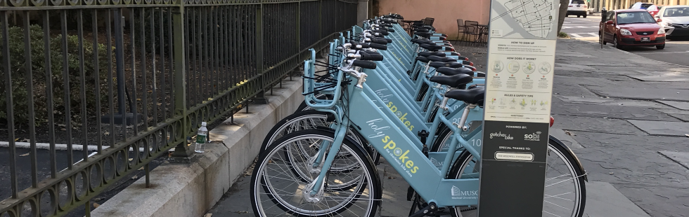
Long-distance transport of passengers and freight is often efficient, but once in the city all forms of transport face what is known as the ‘last-mile problem’, which in reality is both a last-mile and a first-mile problem. In this issue, contributors examine a wide range of strategies to solve or, at least, reduce this problem.
About this issue
Summary
Long-distance transport of passengers and freight is often efficient, but once in the city all forms of transport face what is known as the ‘last-mile problem’, which in reality is both a last-mile and a first-mile problem. In this issue, contributors examine a wide range of strategies to solve or, at least, reduce this problem.

Contents
-
Winning the Last Mile
MOSHE GIVONI -
Exploring Last Mile Synergies in Passenger and Freight Transport
Niklas Arvidsson, Moshe Givoni and Johan Woxenius -
Discourses, Travel Behaviour and the ‘Last Mile’ in London
Robin Hickman and Giacomo Vecia -
Cultural Differences in Children’s One Mile Mobility
Rebecca Shliselberg and Moshe Givoni -
Mobility and the Sharing Economy: Potential to Facilitate the First- and Last-Mile Public Transit Connections
Susan Shaheen and Nelson Chan -
Shared Autonomous Vehicles: Catalyst of New Mobility for the Last Mile?
Michael Ohnemus and Anthony Perl -
Car-Free Urban Areas: A Radical Solution to the Last Mile Problem or a Step Too Far?
Miles Tight, Fiona Rajé and Paul Timms -
The Possible Impact of 3D Printing and Drones on Last-Mile Logistics: An Exploratory Study
Alan C. McKinnon

Homeland: Zionism as a Housing Regime, 1860–2011
As Yael Allweil reveals in her fascinating book, housing has played a pivotal role in the history of nationalism and nation building in Israel-Palestine. She adopts the concept of ‘homeland’ to highlight how land and housing are central to both Zionism and Palestinian nationalism, and how the history of Zionist and Palestinian national housing have been inseparably intertwined from the introduction of the Ottoman Land Code in 1858 to the present day.

On 29 March 2016 the New York based online journal, Realty Today reported ‘Israel is facing a housing crisis with … [the] home inventory lacking 100,000 apartments… House prices, which have more than doubled in less than a decade, resulted in a mass protest back in 2011’.
As Yael Allweil reveals in her fascinating book, housing has played a pivotal role in the history of nationalism and nation building in Israel-Palestine. She adopts the concept of ‘homeland’ to highlight how land and housing are central to both Zionism and Palestinian nationalism, and how the history of Zionist and Palestinian national housing have been inseparably intertwined from the introduction of the Ottoman Land Code in 1858 to the present day.
Following the Introduction, Part I, ‘Historiographies of Land Reform and Nationalism’, discusses the formation of nationalism as the direct result of the Ottoman land code of 1858. Part II, ‘Housing as Proto-Nationalism’ focuses on housing as the means to claim rights over the homeland. Part III, ‘Housing and Nation-Building in the Age of State Sovereignty’, explores the effects of statehood on national housing across several strata of Israeli society. The Afterword discusses housing as the quintessential object of agonistic conflict in Israel-Palestine, around which the Israeli polity is formed and reformed.
Yael Allweil is an Assistant Professor in the Faculty of Architecture and Town Planning at the Technion, Haifa, Israel. Her research centres on the history of housing in Israel and Palestine and the struggles over urban public spaces.
Contents
- Introduction
-
Part I: Housing Outside City Walls: New Forms of Sovereignty in Late Ottoman Palestine
1. Empire Land Commodification and the Backlash of Nationalism
2. Experimentation in Housing for Nationalism 1858–1917 -
Part II: Housing for Proto-Nationalism
3. ‘New Native’ Palestinian Housing: Plantation as Backdrop for Nationalism 1858– 1948
4. ‘Houses Before Street’: Tel Aviv’s Housing-Based Urban Planning by Weiss and Geddes, 1909–1925
5. ‘Today’s Child is Tomorrow’s State’: Kibbutz Children’s House as Nursery for the Good Zionist Subject 1922–1948 -
Part III: Housing and Nation Building in the Age of Sovereignty
6. Immigrant Housing and the Establishment of the State–Citizen Contract, 1948–1953
7. ‘Resistance to Being Swept Away’: Summud Arab-Palestinian Housing in Israel, 1948–2004
8. Differentiated Citizenship in Differentiated Housing, 1948–2005
9. Afterword: For the Nation Yet to Come
Editorial: Big Data, Cities and Herodotus
About this issue
Summary
Big data is everywhere, largely generated by automated systems operating in real time that potentially tell us how cities are performing and changing. A product of the smart city, it is providing us with novel data sets that suggest ways in which we might plan better, and design more sustainable environments.
There is a wonderful quote from The Histories by Herodotus where he says: ‘I will tell the story as I go along of small cities no less than of great. Most of those that were great once are small today; and those that in my own lifetime have grown to greatness, were small enough in the old days’.1 You could say the same about big data. We have always had big data – data that are so voluminous that they tax our ability to represent them digitally or non-digitally, but as our technologies have improved, the data we had in the past now seem small by comparison with what we can handle today. Digital computers were invented during the war years, simultaneously in the USA, UK and Germany, and by 1945 a handful of big but cumbersome digital devices existed in scientific settings. These were then used for intensive numerical processing that we associate with weaponry and defence. In parallel, the process of their miniaturization began with the invention of the transistor at Bell Labs. By the mid-1960s, what came to be called Moore’s law led to super-exponential increases in speed and memory with equivalent ever decreasing costs of production until the present day, where we hold in our hands computable devices with the power of yesterday’s super-computers, a trend that appears to be continuing inexorably. Herodotus would have approved.
Data are following the same course with devices being planted in the environment controlling and generating massive amounts of data in real time. Until a decade ago, most data about cities were taken from one-off surveys conducted at cross-sections in time, often focused on samples from the population. When it came to physical issues, maps and photographs then dominated our visual media. All this has been changed by the move to digital information, and by the 1980s most traditional media were being replaced by computer-drawn maps, remotely-sensed images from satellites, and such like. One-off surveys, too, were being digitized and in the last 20 years, these have been augmented by digital entry and display, with geographic information systems and computer-aided design key examples of advances in such software. As miniaturization has continued, PCs have evolved into hand-held devices – first mobile phones and then smart phones, tablets and now small-scale sensors which are being embedded passively into the environment. All these new processing methods generate data that are available in real time and often at the individual level. We now have passive sensors, which are physically embedded in people and places, and active mobile sensors, which are operated by ourselves, typically through smart phones. This is giving rise to continuing streams of data about the environment, which will be generated as long as the relevant sensors are in operation. This is ‘big data’ in that it is voluminous, often with no known limit in time. It is generated continuously in real time at considerable velocity, and it is of great variety in that it comes from many diverse sources.
There is a good deal of hyperbole surrounding the production of big data with its enthusiasts proclaiming the emergence of such data as providing entirely new insights into the way our cities work. The implication is that a new understanding will come from its analysis. Combined with the notion that sensors in our cities are giving us new ways of automating urban functions, the notion of the ‘smart’ city is now writ-large in our thinking about the way computers and computation might enable us to produce more liveable and sustainable environments. There is a new optimism in the air about what big data and smart cities might do for urban planning and design which is part and parcel of society’s new found interest in cities and city living, particularly in large cities. One has to take much of this commentary with a ‘pinch of salt’ for although big data is providing us with a new focus on how cities function in time, particularly over very short time periods measured in seconds, minutes, hours and days, big data brings with it as many problems as it might solve. Big data is invariably unstructured. It is not collected with urban analysis in mind, unlike many one-off traditional surveys, and it requires considerable ingenuity in computer processing and data mining. It is certainly changing our focus on cities from the long and medium term to the very short term, and in this it is giving us opportunities to enrich our perspective on what makes a better city. But it is also confusing and problematic in that we have to work very hard to introduce structure into it and make it workable for our traditional purposes of understanding. It is exceptionally hard to link different data sets generated for different purposes to one another, for invariably there are no common keys to doing this, and far from dispensing with the need for theory, we need ever better theories for making sense of all this variety.
This special issue collects together a set of papers about big data and the city, providing us with a kaleidoscope of possible applications, which show the promise and pitfalls of big data. The first paper by myself extends this editorial and provides a wider context for big data. We define its various types from traditional sources to real-time streamed data from passive sensors such as that generated from smart cards, to social media which are generated by our active use of smart phones amongst other computable devices such as PCs and tablets. It sets the context for other papers in this issue that take many of these aspects of big data forward as part of the smart cities movement. Almost every facet of the city is touched by the digital revolution and, in terms of scope, there are many different issues about cities that are covered here, from simulation models to new data sources to new theories and methods in planning the city, to new ways in which we as citizens are both using and creating digital information and media. We will begin with the explosion of traditional data into big data, focusing on flows and then examining what these say about locations. We will explore how social media and mobile communications technologies can generate new insights about how we move and function in cities and then we will explore different methods for visualizing this type of data. Visualization is a key focus in making sense of big data and there are several tools that the authors of these papers illustrate here. We will also introduce issues of privacy, confidentiality, and veracity of data while some of these papers try to answer the question of how good such data are, and for what purposes they are being utilized.
We begin by examining data about how people move in cities which explode as we attempt to understand them. Ways of visualizing both traditional flow data from one-off surveys to new data generated from social media and communications require new forms of visualization. In the first paper, some of these are noted but in the second, by Claudel, Nagel, and Ratti, powerful new modes of visualization are introduced, in particular the Datacollider which is a ‘public, powerful, intuitive, and scalable’ device for exploring how flows can be related to one another. Lenormand and Ramasco then show how this kind of new flow data can be extracted and visualized and related to functions in large cities, introducing us to the new world of mobility studies which involves networks and big data. Social media in the form of short text messages make their appearance in this special issue very early and Lenormand and Ramasco illustrate some of the problems of extracting movement patterns from data such as this. The world of social media is plagued by difficulties when it comes to using such media as data to understand cities. The data are often impossible to geo-locate and interactions between users are usually implicit and have to be generated by implication from the raw data.
New data sources, based on using smart cards to pay for transit, are extremely enticing for they provide the possibility of extracting real-time movements which will supplement and complement traditional surveys of traffic. Reades, Zhong, Manley, Milton, and Batty explore how the Oyster Card data that are generated from automatic payment systems on public transport in London can be mined to explore how different stations produce different flows at different times. It is possible to generate inferences about land use at different locations from this kind of data but they show how this kind of analysis can become extremely problematic. This style of data exploration is in its infancy and the notion of inferring pattern in such data requires much more powerful theory about transport in cities than we have at the present time. This paper also notes substantial work in this area on extracting flows and it suggests how locational information can be linked to such movements. Alexiou, Singleton, and Longley also explore location in linking social data to the morphology of small areas in cities, and in this they develop classic methods of data mining, in particular self-organizing maps which enable them to generate new forms of social area analysis in cities. The link from location to morphology is also followed up by Crooks, Croitoru, Jenkins, Mahabir, Agouris and Stefanidis who focus on what has come to be called crowdsourcing or user-generated data which are produced from the population at large. Combined with more traditional data sets, such information enables us to produce very rich patterns of location in cities that help us understand their form and function.
In integrating these diverse sources, Thakuriah, Sila-Nowicka, and Paule introduce an integrated multimedia city data platform which lets them put many kinds of data together to begin the quest of integration, which is one of the long-standing goals of the smart cities movement. Much of these data are crowdsourced and in the next paper, Quercia shows how we can produce mental maps at scale using these new forms of generating data, arguing that it is digital media that enables us to move well beyond the construction of traditional mental maps. We then change tack a little and introduce how big data can enable us to produce more healthy urban environments. Miller and Tolle show how new sources of urban data allow for a ‘deeper understanding of the intricate relationships between individuals, environments and healthy places’, raising issues of privacy and confidentiality that also pervade many of the other contributions to this issue.
We then consider the quality of big data, posing the question ‘how good is it?’ McArdle and Kitchin address this problem directly and show how new and big data sets can be cleaned up using combinations of methods that involve everything from crowdsourcing to new developments in the statistics of data. Carrera then returns to the theme of big data from historic sources making the point that the ‘wise city’, in the form of the ‘smart citizen’, already contains a lot of ‘old’ big data which exists in ‘slow’ real time. Using the example of one of the world’s most historic and iconic cities – Venice – he illustrates how one can make remarkable progress in examining its form and function using the enormous archives of past data that are locked away in such cities. We finish with illustrations of the public face of big data in cities – through the concept of the dashboard. Gray, O’Brien, and Hugel present their work in London, which shows how real-time big data can be organized and classified, thus presenting an appropriate interface to how we can evaluate the quality of life in our cities on a continuing basis.
All of these papers represent the state of an art, which is changing dramatically at the present time. Thus our snapshot of what is happening is highly contingent on the particular times and places to which these articles relate. In the continuing and rapid automation of our cities, a fascinating story can be woven around these speculations into what our cities will be like in both the near and far futures.
Note
1. The quote was first drawn to my attention in Jane Jacobs (1969) which is part of the frontispiece to her book The Economy of Cities (Random House, New York).
Big Data and the City
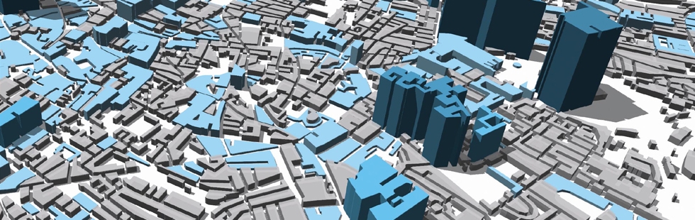
Big data is everywhere, largely generated by automated systems operating in real time that potentially tell us how cities are performing and changing. A product of the smart city, it is providing us with novel data sets that suggest ways in which we might plan better, and design more sustainable environments. The articles in this issue reveal how scientists and planners are using big data to better understand everything from new forms of mobility in transport systems to new uses of social media. Together, they reveal how visualization is fast becoming an integral part of developing a thorough understanding of our cities.
About this issue
Summary
The articles in this issue reveal how scientists and planners are using big data to better understand everything from new forms of mobility in transport systems to new uses of social media. Together, they reveal how visualization is fast becoming an integral part of developing a thorough understanding of our cities.

Contents
-
Editorial: Big Data, Cities and Herodotus
Michael Batty -
Big Data and the City
Michael Batty -
From Origins to Destinations: The Past, Present and Future of Visualizing Flow Maps
MATTHEW CLAUDEL, TILL NAGEL, and CARLO RATTI -
Towards a Better Understanding of Cities Using Mobility Data
MAXIME LENORMAND and JOSÉ J. RAMASCO -
Finding Pearls in London’s Oysters
JON READES, CHEN ZHONG, ED MANLEY, RICHARD MILTON and MICHAEL BATTY -
A Classification of Multidimensional Open Data for Urban Morphology
ALEXANDROS ALEXIOU, ALEX SINGLETON, and PAUL A. LONGLEY -
User-Generated Big Data and Urban Morphology
A.T. CROOKS, A. CROITORU, A. JENKINS, R. MAHABIR, P. AGOURIS and A. STEFANIDIS -
Sensing Spatiotemporal Patterns in Urban Areas: Analytics and Visualizations Using the Integrated Multimedia City Data Platform
PIYUSHIMITA (VONU) THAKURIAH, KATARZYNA SILA-NOWICKA, and JORGE GONZALEZ PAULE -
Playful Cities: Crowdsourcing Urban Happiness with Web Games
DANIELE QUERCIA -
Big Data for Healthy Cities: Using Location-Aware Technologies, Open Data and 3D Urban Models to Design Healthier Built Environment
HARVEY J. MILLER and KRISTIN TOLLE -
Improving the Veracity of Open and Real-Time Urban Data
GAVIN MCARDLE and ROB KITCHIN -
Wise Cities: ‘Old’ Big Data and ‘Slow’ Real Time
FABIO CARRERA -
Collecting and Visualizing Real-Time Urban Data Through City Dash-Boards
STEVEN GRAY, OLIEVER O’BRIEN and STEPHAN HÜGEL